Skip to content
A Safety Guy in Colombia

Bucket list

The map shows where I have been. This list is what is still ahead. A river in the Amazon, a waterfall you can see from far away, whales off the Pacific coast, a volcano, macaws, and a few mountains I want to climb on foot. Ticked entries lead to the page of the place, where the photos already are.

6 of 74 done

An empty ring is a place I have not been to yet. A solid dot is a ticked entry and leads to its page.

74 items

Antioquia

  • Medellín

    City · 1495 m above sea level
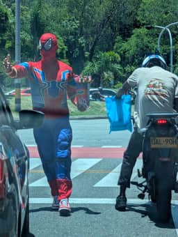
    Done 5 September

    The city of eternal spring, where I live now. A metro, cable cars up the hillsides, cafés you can work from, and neighbourhoods more different from each other than two separate cities.

    It is ticked because I live here, not because I have seen all of it. Comuna 13, Laureles and the old centre already have their own pages in the journal.
    Entries and photos from here

  • Parque Arví

    Park · 2400 m above sea level

    Done 30 August

    A pine forest above Medellín, reached by cable car across the whole eastern side of the valley. It is ten degrees cooler up there, mist hangs between the trunks and the trails will fill a whole day.

    The ride up is half the point: the roofs of Santo Domingo slide past under your feet.

    Entries and photos from here

  • Jardín

    Town · 1750 m above sea level

    Done 28 August

    A small town three hours to the southwest, where people really do sit on the square all day. Coffee farms all around, a café full of hummingbirds above the town, waterfalls in the valley and a cable car across the gorge.

    It is the one place where doing nothing felt entirely obvious.

    Entries and photos from here

  • La Ceja del Tambo

    Town · 2200 m above sea level

    Done

    A small town in eastern Antioquia, in the belt where the flowers are grown and where it is five degrees cooler than in Medellín. White houses, a large church, and a square people walk around on Sundays.

    One of those towns you go to from the city for the quiet, not for the sights.

  • Guatapé

    Town

    Done 6 September

    The most colourful town in the country. The base of every house carries a relief telling you who lived there and what they did for a living, and all around lies a lake made by flooding a valley for a dam.

    The old town of Peñol is still down there, church and all.

    Entries and photos from here

  • Piedra del Peñol

    Viewpoint · 2135 m above sea level

    Done 6 September

    A rock sticking out of the rolling landscape like a mistake. Seven hundred and forty steps are wedged into a crack in it, and from the top you see the lake broken into hundreds of inlets.

    Go early. Arrive at eleven and you queue on the stairs.

    Entries and photos from here

  • Cerro Tusa

    Mountains · 1850 m above sea level

    A natural pyramid near Venecia, visible from the road between Jardín and Medellín. It looks built, but it is a block of rock that weathering has cut into a three sided pyramid, and it is held to be the largest natural pyramid in the world.

    A steep path leads to the top, so the trip is a climb rather than a walk. This is the hill I see from the bus window every time and every time tell myself I will get up there.

    When
    December to March, the drier months
    How
    You start from Venecia and count on five to six hours up and down. The last stretch is over bare rock and is no place to be in the rain.
  • Cañón del Río Claro

    Nature

    A marble canyon with a green river three hours east of Medellín. The water is clear, the walls are covered in forest, and blue morphos drift between them, the big metallic butterflies that are the real reason I want to go.

    You sleep in cabins with one wall missing, right above the river, so the water is the last thing you hear.

    How
    Buses to Bogotá stop at the reserve, but you have to tell the driver when you get on.
  • Jericó

    Town · 1900 m above sea level

    A town in the coffee hills that gets talked about less than Jardín, which is exactly the appeal. It is where the carriel is made, the leather shoulder bag with ten pockets that paisa men carry.

    Above the town a hill looks out over the whole Cauca valley, and the path up runs between cactus and bamboo.

  • Santa Fe de Antioquia

    Town

    The old capital of Antioquia, two hours to the northwest and ten degrees hotter than Medellín. Cobbles, white walls, colonial churches and a heat that slows everyone down.

    Just outside town a bridge from 1895 hangs across the Cauca river, the longest in South America when it was built.

  • Cueva del Esplendor

    Cave

    A cave above Jardín whose roof collapsed into a hole, and through that hole a waterfall drops straight inside. The light comes down with the water and you can stand under both.

    I have been to Jardín and left this for later. You get there on horseback or by jeep, then walk the last stretch.

Coffee region

  • Valle de Cocora

    Nature · 2400 m above sea level

    A valley near Salento with wax palms over sixty metres tall rising out of it. It is the national tree of Colombia and grows nowhere else like this: thin white trunks standing in the mist like columns with the roof taken away.

    This is the palm grove half the world's photographers come to Colombia for, and I do not think they are overdoing it.

    How
    Walk the loop anticlockwise so the palms come last. It rains up there most afternoons.
  • Valle de Samaria

    Nature

    The other wax palm valley, the one almost nobody knows. It lies in Caldas near Norcasia and is reckoned to be the largest wax palm forest in the world.

    No paved road, no stalls. If you want that picture without a queue of people in rented wellies, you come here instead of Cocora.

  • Nevado del Tolima

    Volcano · 5220 m above sea level

    A symmetrical volcanic cone with a glacier on top, five thousand two hundred and twenty metres. The climb takes three or four days through páramo and hot springs, and the last night starts at two in the morning.

    This is the high mountain I want to stand on, not walk around. So far my highest is Arví at two thousand four hundred.

    When
    December to February
    How
    Pointless without a guide and without acclimatising. The last stretch is on ice, so crampons and an axe.
  • Nevado Santa Isabel

    Volcano · 4950 m above sea level

    Los Nevados national park, where above four thousand metres you walk on ash between frailejones. Santa Isabel has lost almost all of its glacier and is the fastest disappearing place in the country.

    I want to see it while there is still something white up there. The estimates talk in years, not decades.

  • Termales de Santa Rosa

    Hot spring

    Hot springs directly under a waterfall near Santa Rosa de Cabal. Cold mountain water crashes down beside pools you sit in at forty degrees.

    Evenings in the coffee highlands are cold and foggy, which makes this half the reason to go.

  • Reserva Río Blanco

    Wildlife

    A reserve above Manizales where around three hundred and sixty bird species have been recorded. It is best known for antpittas, which anywhere else stay hidden in the undergrowth.

    You go at first light with binoculars and it drizzles the rest of the day. It is not an aviary, it is a forest with someone who knows where to look.

  • Filandia

    Town

    A colourful town in the coffee region that Salento relieved of its tourists, leaving it as itself. Wooden balconies, five colours of shutter on a single house, and cafés serving what grows just outside.

    From the lookout tower above town you can see three departments at once.

Bogotá and around

  • Bogotá

    City · 2640 m above sea level

    Eight million people at two thousand six hundred metres, which is to say a city where you walk slowly on the first day.

    I want La Candelaria with its colonial courtyards, the Gold Museum that is the best of its kind anywhere, the Paloquemao market at dawn, and the Sunday ciclovía when a hundred kilometres of street close to cars.

  • Monserrate

    Viewpoint · 3152 m above sea level

    A church on a hill above Bogotá at three thousand one hundred and fifty two metres. A cable car goes up, so does a funicular, and so do stairs that locals run in the morning.

    From the top you watch the city run out across the plain until it dissolves into haze. It has no edge, it just fades.

  • Zipaquirá

    History

    A cathedral carved into a salt mine a hundred and eighty metres underground. Corridors with the stations of the cross, blue lighting, and a silence churches above ground never have.

    Salt has been mined here since the Muisca, long before the Spanish arrived, and if you lick the wall you will know it.

  • Laguna de Guatavita

    Lake · 3000 m above sea level

    A round lake in a crater where the Muisca threw gold during the ceremony that became the legend of El Dorado. A new chief would cover himself in gold dust and float out on a raft.

    The Spanish tried to drain it three times and once cut a notch through the crater wall to do it. The notch is still there.

  • Villa de Leyva

    Town

    The largest cobbled square in South America, ringed by white colonial houses that have barely changed since the sixteenth century.

    Around the town lie dry hills, fossils of marine reptiles in a place with no sea anywhere near, and blue pools left behind by sand quarrying.

  • Monguí

    Town · 2900 m above sea level

    A stone town in Boyacá often called the prettiest village in the country, and yet almost nobody goes. Most of Colombia's footballs are stitched here, by hand, in people's houses.

    Just outside town the Ocetá páramo begins, spoken of as the most beautiful páramo anywhere.

  • Cascada La Chorrera

    Waterfall · 2300 m above sea level

    The highest waterfall in Colombia at five hundred and ninety metres, an hour and a half from Bogotá. You walk an hour through cloud forest full of tree ferns.

    Then you stand under a wall of water that arrives at the bottom as mist. A little lower there is a second fall called El Chiflón.

  • Páramo de Chingaza

    Nature · 3300 m above sea level

    The páramo above Bogotá that supplies the whole city with water. Frailejones grow there, the silver plants that look like people in fur coats and take a century to gain a metre.

    Spectacled bears live there, though almost nobody sees one. You need a permit and it is almost always in fog.

Santander and Boyacá

  • Barichara

    Town

    A sandstone town often called the prettiest in Colombia, and this time it probably is. Golden walls, paving from a single quarry, and shutters that close at midday.

    From here the old stone Camino Real runs down to the village of Guane, five kilometres downhill between cactus and goats.

  • Cañón del Chicamocha

    Nature

    A canyon over two kilometres deep, crossed by a six kilometre cable car, the longest in the country. Dry country with cactus and goats, cut by a river into a trench nobody expects in the tropics.

    Paragliders launch from the rim, and it is one of the best places in the world to do it.

  • Cascada de Juan Curi

    Waterfall

    A hundred and eighty metres of water dropping into a green pool you can swim in. An hour's walk from San Gil, and the kind of waterfall you can reach in trainers.

    You can abseil the wall beside the water if looking at it is not enough.

  • Las Gachas

    River

    A red creek near Guadalupe where the water has worn dozens of round holes, each about the size of one person. You sit in them as in a jacuzzi cut into rock.

    It is three hours from the nearest tourist town and few people know about it, Colombians included.

  • Ritacuba Blanco

    Mountains · 5330 m above sea level

    The highest summit of the Sierra Nevada del Cocuy at five thousand three hundred and thirty metres, and one of the last real glaciated mountains in the country. Below it lies a chain of lakes and rock towers people call the Colombian Himalaya.

    The park is often closed, because it is sacred to the U'wa and the glacier is retreating. I want to go while it is still possible.

    How
    The park opens and closes by agreement with the U'wa council. Check before you travel or you will arrive at a closed gate.

The Caribbean coast

  • Santa Marta

    City

    The oldest surviving city in South America, founded in 1525, and the base for everything nearby: Tayrona, Minca and the Lost City.

    In itself it is hot, loud and a little battered, but the sunsets over the bay and the fish market make up for it. Bolívar died here.

  • Parque Tayrona

    Beach

    A national park where the jungle ends in the surf. You walk between the bays over tree roots, sleep in a hammock at Cabo San Juan, and howler monkeys roar in the canopy overhead.

    A Caribbean beach as it should be: no concrete, rainforest at your back. You cannot swim everywhere, the currents are treacherous.

    When
    outside December and January, when it is full
    How
    The park closes for a few weeks each year so the land can rest. The dates are announced in advance.
  • Cerro Kennedy

    Mountains · 3000 m above sea level

    From Minca you can walk up Cerro Kennedy, which locals call Cerro Nuevo Mundo. On a clear morning you see the snow peaks of the Sierra Nevada and the Caribbean at the same time.

    A mountain with a sea view, at three thousand metres. Nowhere else in Colombia works like that.

  • Ciudad Perdida

    History

    Teyuna, the stone city of the Tayrona in the Sierra Nevada, built around the year 800, six centuries before Machu Picchu.

    It takes four days through jungle, several river crossings and nights in hammocks. At the end there are twelve hundred steps and round terraces in the mist. The land belongs to the Kogi and you go only with them.

  • Cabo de la Vela

    Beach

    A desert that ends in the Caribbean, on Wayúu land at the northern tip of the continent. Rust coloured ground, turquoise water, not one tree, and a hammock under a shelter for the night.

    From here you go on to Punta Gallinas, the northernmost point of South America, where a dune drops straight into the sea.

  • Cartagena de Indias

    History

    Walls, coloured balconies and the most photographed city in the country. It is overexposed and expensive, no denying it.

    It is also the best preserved colonial fortification in the Americas, and Getsemaní in the evening, when people dance on the square and nobody charges for it, is worth the price of admission.

  • Rincón del Mar

    Beach

    A fishing village on the Caribbean coast where hammocks between palms stand in for hotels. It is the jumping off point for the San Bernardo islands.

    At night the water glows with bioluminescent plankton, and on the islet of Santa Cruz del Islote twelve hundred people live on less than two football pitches.

  • Capurganá a Sapzurro

    Beach

    Two villages right on the Panamanian border with no road to either. You arrive by small plane or by boat, and walk between them over a jungle ridge.

    Coral reefs, no cars, the edge of the map. Panama is over the ridge and you can walk there.

  • Mompox

    History

    A colonial town on the bank of the Magdalena that stayed where it was when the river moved and the trade went elsewhere. That is exactly why it never changed.

    Filigree silverwork, white walls, and the silence in which Chronicle of a Death Foretold was filmed. Bolívar said he owed his independence to Mompox.

  • Volcán del Totumo

    Volcano

    A mud volcano fifteen metres high with a wooden ladder up to the crater. Inside you float in warm grey mud so dense you cannot sink.

    It is absurd, which is exactly why I want to try it. You rinse off in the lagoon next door.

The Pacific and Chocó

  • Nuquí a Guachalito

    Beach

    The black beaches of Chocó, where jungle falls straight into the ocean and the nearest road is behind the mountains. From July to October humpbacks come here to calve and you can watch them from the sand.

    You walk through jungle to the hot springs and down to the sea with the tide. Chocó is the rainiest place on earth, so count on water from above as well as below.

    When
    July to October for the whales
    How
    No road goes here, you fly in from Medellín on a small plane. It rains almost every day and that is part of it.
  • Bahía Málaga

    Sea

    A bay near Buenaventura where humpbacks gather in their hundreds each summer. You go out in small boats and the whales breach close enough that you hear them land.

    It is the surest place in Colombia to see them and the easiest to reach: a day from Cali.

    When
    July to October
  • Parque Nacional Utría

    Nature

    A national park where mangroves, coral reef and cloud forest sit side by side in one inlet. Whales choose it to give birth because it is calm and shallow.

    You sleep in cabins over the water and cross the mangroves on a wooden walkway. It is one of the least touched corners of the country.

  • Isla Gorgona

    Island

    An island that was a prison for the worst cases until 1984 and is now a national park. Jungle is growing through the cell blocks.

    Whales and turtles pass offshore, there are reefs with sharks below, and the forest holds one of the highest densities of venomous snakes anywhere. Which is why you stay on the marked paths.

The Amazon

  • Puerto Nariño

    River

    A village where the Loretoyacu meets the Amazon, with no cars allowed and rubbish sorted since long before anyone else in the country thought of it. You walk everywhere and you can hear the forest.

    From here you go out to Lake Tarapoto to look for pink river dolphins. This is the good place in the Amazon I am after: not Leticia, but this village two hours downstream.

    How
    Boats leave Leticia twice a day and the trip takes about two hours.
  • Parque Amacayacu

    Nature

    A national park on the north bank of the Amazon with walkways strung through the canopy, thirty five metres up.

    It holds the smallest monkeys in the world, pygmy marmosets the size of your palm, over five hundred bird species, and big macaws that cross the river in pairs. You go into the forest with someone who grew up in it.

The plains and the Orinoco

  • Caño Cristales

    River

    A river that turns red for a few months a year. An aquatic plant called Macarenia clavigera grows on the bed, and when the water and light are right the channel runs red, yellow, green and blue at once.

    Out of season it is an ordinary clear stream, so you cannot just turn up. It lies in the Serranía de la Macarena, where the Amazon, the Andes and the plains meet.

    When
    June to November
  • Hato La Aurora

    Wildlife

    A ranch in Casanare the size of a small district, which its owners stopped grazing decades ago and turned into a reserve.

    You ride out across the savanna after capybaras, giant anteaters, anacondas and flocks of blue and yellow macaws that sit in the palms by the dozen. If you want to see animals in Colombia you go to the plains, not the Amazon: on the savanna you see them, in the forest you only hear them.

    When
    December to March, when the dry season pushes the animals to the water
  • Cerros de Mavecure

    Mountains

    Three granite hills rising out of the forest above the Inírida river, part of the Guiana Shield and some of the oldest rock on the planet.

    The smallest can be climbed in about an hour, and from the top there is nothing but forest and water in every direction. It is one of the hardest places in the country to reach and one of the most beautiful.

The southern Andes

  • Cali

    City

    The salsa capital of the world, where Tuesday nights are as busy as Saturdays and children learn to dance before they learn to write.

    Hot, loud and the least polished of Colombia's big cities. Cristo Rey stands above it, along with Tres Cruces hill, which locals run up in the morning instead of going to a gym.

  • San Cipriano

    River

    A village in the Pacific rainforest reached along a railway line on carts pushed by motorbikes. Locals built them when the trains stopped and no road was ever laid.

    The river is clear enough to see the bottom three metres down, and you float downstream on an inner tube.

  • Desierto de la Tatacoa

    Nature

    A red and grey semi desert cut through with gullies, two hours from Neiva. Strictly it is dry tropical forest, but it looks like Arizona.

    Over forty degrees by day, and at night a sky clear enough that there is an observatory. I want to sleep outside there and look up.

  • San Agustín

    History

    The largest group of megalithic statues in South America, five hundred stone figures scattered across hills above the Magdalena canyon.

    Nobody knows for certain who carved them or why. Coffee farms lie all around and you can spend a day riding between the sites on horseback.

  • Salto de Bordones

    Waterfall

    Four hundred metres of free fall into a green canyon, one of the highest waterfalls in the country, an hour from San Agustín.

    You see it from the opposite slope, so you take it in whole, from the lip to the mist at the bottom. With tall waterfalls that almost never happens.

  • Volcán Puracé

    Volcano · 4650 m above sea level

    An active volcano in the Cauca range that can be climbed in one long day. At the top there is a crater giving off sulphur and a view along a chain of other volcanoes.

    Below it are hot springs and a station where condors were released back into the wild. With luck you see them from the trail.

    How
    You start at three in the morning, the route crosses Kokonuko land and you go only with their guide.
  • Laguna Verde del Azufral

    Volcano · 4070 m above sea level

    A crater lake the colour of green glass inside the Azufral volcano near Túquerres. Dissolved sulphur makes the colour and it shifts with the light.

    It is almost on the Ecuadorian border and it is mostly locals who go. Three hours up through páramo, with the last stretch on volcanic sand.

  • Laguna de La Cocha

    Lake · 2800 m above sea level

    A lake near Pasto surrounded by wooden houses with steep gables and flowers in the windows, as though someone had carried them over from the Alps.

    In the middle lies Corota island, one of the oldest protected cloud forests in the country. A boat takes you across for a few thousand pesos and it is an hour's walk on a boardwalk between the trees.

  • Santuario de Las Lajas

    History

    A neo gothic church built as a bridge across a gorge, a hundred metres above the Guáitara river. It looks invented, but it has stood there since 1949.

    Pilgrims come from across the Americas, and on the rock behind the altar is an image nobody claims to have painted. It is the last stop before the Ecuadorian border.

  • Cascada Fin del Mundo

    Waterfall

    A waterfall near Mocoa in Putumayo where the water goes over a lip into nothing, and you can sit on that lip with your legs over the edge.

    The walk in follows the river and crosses tree roots and takes two hours. Putumayo is where the Andes end and the Amazon begins, and you can see it from every hill.

The islands

  • San Andrés

    Island

    A coral island closer to Nicaragua than to Colombia, ringed by a sea with seven distinguishable shades of blue.

    People speak Creole, listen to reggae and eat fish with coconut. You can ride around it on a scooter in an afternoon, and the best part is the lagoon at Rocky Cay, where you can walk a hundred metres out to sea.

  • Providencia

    Island

    The smaller, quieter sister of San Andrés, two hours by catamaran or twenty minutes by plane. The third largest barrier reef in the world lies around it.

    The Peak is a two hour walk and shows you the whole island. After hurricane Iota flattened nearly every house in 2020, the island rebuilt itself.

Things to do

  • Parapente ze San Félix

    Sport · 2400 m above sea level

    A launch ramp above Bello at two thousand four hundred metres, straight out over the Aburrá valley. Seeing Medellín from above with no aircraft window between you and the city is a different thing from the cable car.

    It is half an hour from my flat, which makes it the most reachable adventure on this list and the one I keep putting off.

    When
    all year, flights are in the morning
    How
    Half an hour from Medellín through Bello. You arrange a tandem on the spot, but mornings mean a shorter queue and calmer air.
  • Rafting na Río Suárez

    Sport

    Grade four to five and one of the best rivers on the continent. It runs near San Gil, in a region that has been doing adventure tourism properly for a long time.

    The canyon is deep, and between the rapids there is a quiet that never makes it into the videos.

    When
    most water from April to November
    How
    The Fonce near San Gil is the gentler option for a first run. The Suárez is a full day and is no place to start.
  • Sběr kávy na farmě

    Farm

    I want to find out what one day of a recolector's work actually is: a basket at your waist, a slope you cannot stand straight on, and pay by the kilo of ripe cherries.

    Everybody here drinks the coffee and hardly anyone talks about the picking. Without that day I would only ever write what you can see from the terrace.

    When
    main harvest October to December, a smaller one April to June
    How
    Not a tour with a tasting but a day in the line with everyone else. You arrange it at the farm and you are expected to work the whole shift.
  • Kitesurfing v Cabo de la Vela

    Sport

    From December to March the wind in La Guajira barely stops, and the lagoon at Cabo de la Vela is shallow and flat as a table.

    You sleep in a hammock under a shelter on Wayúu land, the power comes from a generator, and the day is spent moving across the water. None of it needs a paved road.

    When
    December to March, when the wind is strongest
    How
    Shallow, flat water, which makes it one of the best places in the world to learn. Schools and kit are in the village itself.
  • Potápění u Malpela

    Sea

    A rock island five hundred kilometres out in the Pacific, a UNESCO site and one of the few places on earth where you can see hammerheads in schools of hundreds.

    It is the hardest and most expensive item on this list and I will probably save for it for years. Which is part of why it is here.

    When
    January to May for visibility
    How
    A boat from Buenaventura takes about a day and a half and you sleep aboard. It needs an advanced certification and real experience with currents, not a holiday open water card.
  • Alto de Letras na kole

    Mountains · 3679 m above sea level

    Eighty kilometres of climbing with not one descent, from Mariquita at four hundred and ninety metres to the Letras pass at three thousand six hundred and seventy nine. It is reckoned to be the longest continuous paved climb in the world.

    I am no racer and I will probably split it over two days. But it is a mountain you can get up under your own power, which is exactly the point.

    When
    December to March, when there is less fog at the top
    How
    You leave Mariquita around five in the morning. It is over thirty degrees at the bottom and around four at the top. You carry the extra layers, you do not buy them on the way.
  • Lezení v Suesce

    Sport · 2600 m above sea level

    Sandstone walls above the savanna at two thousand six hundred metres, where Colombian climbing started. There are hundreds of routes, from a first afternoon with an instructor to things I will never touch.

    Climbing at two thousand six hundred metres is different work from climbing at home, and I want to know by how much.

    When
    December to March and July to August
    How
    An hour and a half from Bogotá. The cliffs run along an old railway line, so you climb straight off the path with no approach walk.
  • Hnaní dobytka s llaneros

    Wildlife

    Work on the plains is a culture of its own: horses, cattle, joropo after dark, and people who grew up in the savanna. The vaquería happens in the dry season, when the herds are moved towards water.

    I want to see how work is done in a landscape that is flat to the horizon and still not empty.

    When
    December to March, in the dry season
    How
    You arrange it at the hatos, the ranches that take guests. It starts before dawn and most of the day is in the saddle.
  • Global Big Day, ptačí rekord

    Wildlife

    Colombia has more bird species than any other country, around nineteen hundred, and has won the worldwide count several times in a row with over fifteen hundred species in a single day.

    This is the only entry with no point on the map, because it happens across the whole country at once. I want to be out for it, and where hardly matters.

    When
    the second Saturday in May, a smaller round in October
    How
    It is not a contest for specialists. You log into eBird and a back yard counts, so you can go out with anyone who knows where to look.
  • Silleteros na Feria de las Flores

    City

    Growers from Santa Elena carry wooden frames of flowers on their backs, some weighing seventy kilos, along the whole parade route. It grew out of the way flowers were once carried down to the city to be sold.

    Santa Elena is also where the water for half of eastern Medellín comes from. I only put those two together while writing about the rationing.

    When
    the beginning of August
    How
    The parade is on the last day of the festival and places along the route are taken from the morning. To see a silleta being built, go up to Santa Elena the day before.
  • Semana Santa v Popayánu

    History

    The night processions in the white city have run without a break since 1556 and UNESCO lists them as intangible heritage. Wooden platforms carrying statues are shouldered through the streets, each with its own bearers and its own rules.

    I am not religious and I want to see it anyway. It is the oldest unbroken thing I can witness in this country.

    When
    Holy Week, the processions are after dark
    How
    Accommodation in Popayán sells out months ahead for that week. Arrive late and you sleep in Cali and commute.
  • Yipao, průvod jeepů v Calarcá

    Transport

    A parade of Willys jeeps loaded so absurdly high you cannot describe it without a photograph: furniture, sacks of coffee, chickens, an entire household on one wartime vehicle.

    It has categories and rules and people compete in it. It is the best possible demonstration of how everything gets carried in the coffee region.

    When
    June, during the coffee festival
    How
    The best part is the category where the jeep drives on its back wheels. Watch from behind the barrier, not from the roadside.

Newsletter

A new entry in your inbox, not in an algorithm

Roughly once a fortnight. No ads, no selling addresses, and one click to unsubscribe from every email.

Ask